SDG Conference Day 0 Arqus Workshop, Spring 2022
Miro board: https://miro.com/app/board/uXjVON2UUpg=/?invite_link_id=934380361248
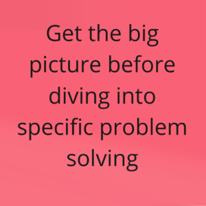
As part of Day 0 for the SDG Conference Bergen , a group of international participants, under the leadership of Brooke Wilkerson, used systems mapping to identify research priorities for urban climate transformation. After creating a shared systems map, they developed a list of variables and relationships that were especially interesting and/or unclear, then placed those items in a matrix with one axis for importance and a second axis for uncertainty. This pilot workshop shows great potential for using systems mapping in engaging stakeholders in setting research agendas. As one participant wrote: “I think the mapping is a fantastic way to facilitate debate: you force people to be very specific about the reasoning behind their arguments, simply by asking them “How would you add it to the map?” Moreover, to answer that questions, they have to explain how their thoughts relate to what has already been said. This makes for mutual understanding.”
More information is available here: https://www.uib.no/en/arqus/151549/interactive-workshop-micromobility-bergen
Professional Short Course, World Food System Center, ETH Zurich, Spring 2021
The overall theme of the short course was “Designing for Food Systems Resilience: A Circular Approach” and it pursued the following learning objectives for the course are as follows:
- Discuss and examine the elements of agroecology, with a focus on circularity and resilience, to build sustainable food systems
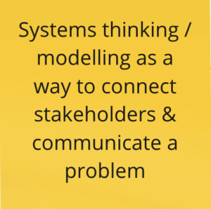
- Apply systems thinking and transdisciplinary approaches to understand the system and design interventions
- Extend your professional network
- Collaborate with colleagues from diverse cultural and disciplinary backgrounds
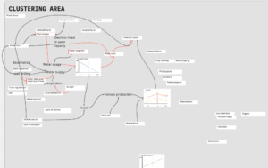
In order to reach learning objective 2, Brooke and Birgit facilitated a 2.5 hour systems mapping session where participants first received a 15 minutes introduction to systems thinking and systems mapping and then developed an initial systems map that illustrates and visualizes the processes underlying resilience of tomato production in Morocco. As we were working with a group of 30 participants, we had to make sure that we alternated between divergent and convergent activities often enough to keep participants interested and engaged.
In a preceding activity, participants had already been provided with an overview of the sustainability and resilience challenges regarding tomato production in Morocco. Those challenges can roughly be summarized as: declining water availability; widening gap between small producers’ and exporter producers’ income; and nutrient runoff from tomato production.
At the start of the session, participants split into groups and brainstormed about behavior over time graphs for the direct drivers of the three sustainability and resilience challenges. This turned out to be an important activity to engage so many participants but of course, it took longer than anticipated.
We obviously did not have enough time to develop a comprehensive map. However, in the short amount of time that we did have, we found a very nice example of a “fixes that fail” archetype: In times of water scarcity, investments are made to drill more wells. These wells allow, in the short run, to close the water gap. In the long run, however, well drilling lowers the groundwater table further and increases the gap between water demand and supply again.
Some participant feedback at the end of the entire short course (as a response to the question “What are the most important take aways from the course for you?”):